Playa Santa Lucia beach
Ultimate guide (June 2026)
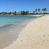
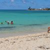
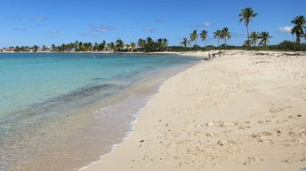
Playa Santa Lucia is a very long beach in the north coast of Cuba, located not far from Camaguey city. Few beach areas have their own names: Playa los Cocos and La Boca. There are usually a lot of seaweed on the beach areas remoted far from the major hotels. Shore and seabed: sand. [edit]
Coordinates: 21.563404, -77.041744
See also: Cuba island
Hotels [edit]
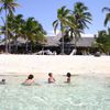
There are about dozen of big beach resorts in Santa Lucia. Brisas Santa Lucia is the most notable one.
How to get there [edit]
Fly to Havana Airport (HAV), or fly to Varadero Airport (VRA), or fly to Camaguey Airport (CMW), or fly to Holguin Airport (HOG). Next get by taxi or by Viazul bus.
When to go [edit]
There is no pronounced seasonality on the northern coast of Cuba. Sea water is warmer in summer, but there's less rain in winter.Rainfall, mm

Water temperature, C
Temperature, C
Humidity, %
Wind speed, meter/sec
See also other beaches nearby:
240 km to the north-west ↖