Beach-on-Map.com The Free Beach Guide HomeCountriesMenu

Anakena beach

Ultimate guide (April 2024)
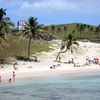
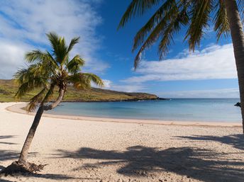
Anakena - the best beach in the Easter island. There are many palms on the beach, white sand, and besides there is a group of Moai statues nearby. Sea water warms to a relatively comfortable temperature in the warm half of the year. Shore and seabed: sand. [edit]
This beach ranks #103 of the "Best beaches in Oceania"
Rating: 8.3 - 350 votes [vote]
Coordinates: -27.073, -109.322505
See also: Easter island

Hotels [edit]

There are no hotels near the beach. The nearest hotels are in Hanga Roa town.

How to get there [edit]

Fly to Mataveri airport. Continue by taxi.

When to go [edit]

From December to April. The rest of time sea water is too cold.

Rainfall, mm
Rainfall, mm

Water temperature, C

Temperature, C
Temperature, C

Humidity, %
Humidity, %

Wind speed, meter/sec

Open map

See also other beaches nearby:

 
Galapagos islands, Isabela island, Puerto Villamil, Iguana Point Bar 8.0
3500 km to the north-east
Location: South America, Ecuador, Galapagos islands
Rating: 8.0 (364 votes)
Galapagos islands, Fernandina island, cactus on lava field 5.7
3540 km to the north-east
Location: South America, Ecuador, Galapagos islands
Rating: 5.7 (201 votes)
Galapagos islands, Espanola island, Gardner Bay, seal 7.9
3550 km to the north-east
Location: South America, Ecuador, Galapagos islands
Rating: 7.9 (214 votes)
Galapagos islands, Santa Cruz island, sea lion and pelican 7.4
3560 km to the north-east
Location: South America, Ecuador, Galapagos islands
Rating: 7.4 (528 votes)
Galapagos islands, Bartolome island, view to Pinnacle rock 7.7
3590 km to the north-east
Location: South America, Ecuador, Galapagos islands
Rating: 7.7 (335 votes)
💖
If you liked this page, please share it on: Facebook, Twitter, Instagram
…or any other web-site
 
This will help the project greatly!

 
To the top of this page »
 
© 2024, Beach-on-Map.com · Menu