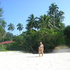
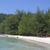
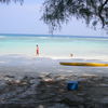
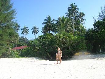
Beach-on-Map.com The Free Beach Guide HomeCountriesMenu

Flora Bay beach

Ultimate guide (April 2024)
Flora Bay - beach in the south of the Big Island. Shore and seabed: sand. [edit]
This beach ranks #3 of the "Best beaches in Perhentian Islands"
Rating: 7.9 - 76 votes [vote]
Coordinates: 5.892339, 102.747707
See also: Perhentian Islands

Hotels [edit]

Best value for money hotels are located here.

How to get there [edit]

Fly to Kuala Lumpur airport, then to Kota Bharu airport. Then by taxi to Kuala Besut town's pier. Then sail 20 minutes by big motor boat.

When to go [edit]

From March to August.

Rainfall, mm
Rainfall, mm

Water temperature, C

Temperature, C
Temperature, C

Humidity, %
Humidity, %

Wind speed, meter/sec

Open map

See also other beaches nearby:

 
Malaysia, Perhentian Islands, PIR beach, under the palm tree 8.5
PIR / open » /
1.3 km to the north-west
Location: Southeast Asia, Malaysia, Perhentian Islands
Rating: 8.5 (510 votes)
Malaysia, Perhentian Islands, Blue Lagoon beach, kayak 8.9
2.2 km to the north
Location: Southeast Asia, Malaysia, Perhentian Islands
Rating: 8.9 (3136 votes)
Malaysia, Lang Tengah, Pasir Air beach 8.7
19 km to the south-east
Location: Southeast Asia, Malaysia, Lang Tengah
Rating: 8.7 (420 votes)
Malaysia, Lang Tengah, Dewati beach 8.3
20 km to the south-east
Location: Southeast Asia, Malaysia, Lang Tengah
Rating: 8.3 (168 votes)
Malaysia, Lang Tengah, Coconut Lagoon beach 7.9
20 km to the south-east
Location: Southeast Asia, Malaysia, Lang Tengah
Rating: 7.9 (15 votes)
💖
If you liked this page, please share it on: Facebook, Twitter, Instagram
…or any other web-site
 
This will help the project greatly!

 
To the top of this page »
 
© 2024, Beach-on-Map.com · Menu